
Information You Need: Tuscaloosa, West Alabama Live Severe Weather Updates
At 9:48 pm the National Weather Service in Birmingham has cleared Pickens and Tuscaloosa from the Tornado Watch.
______________________________________________________________________
At 9 pm the National Weather Service in Birmingham cleared Greene and Sumter from the Tornado Watch.
______________________________________________________________________
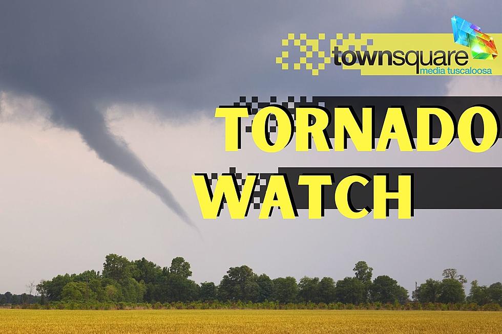
The National Weather Service in Birmingham has issued a Tornado Watch.
This is for Tuesday, January 22, 2022, from now until Midnight.
For the following counties:
Fayette
Greene (removed at 9 pm)
Lamar
Pickens (removed at 9:48 pm)
Sumter (removed at 9 pm)
Tuscaloosa (removed at 9:48 pm)
Walker
Here are the counties included in this Tornado Watch but not a part of the Townsquare Media Coverage area but we wanted to make you aware of them are:
Colbert
Cullman
Franklin
Lauderdale
Lawrence
Limestone
Madison
Marion
Morgan
Winston
______________________________________________________________________
Today, Tuesday, February 22, 2022, you can expect a warmer day, with a high near the mid-70s. Also, there will be a few scattered showers during the day. We are closely monitoring a system that will bring the possibility of severe weather and flooding to West and Central Alabama this evening.
Since the potential for severe weather runs in the evening hours. I encourage you to not silence your phones when you go to bed. Therefore, if any severe weather develops you can be notified. As always, weather information changes and we will bring necessary updates right here.

According to the National Weather Service in Birmingham said that “thunderstorms will develop along/ahead of the front, and a few may become severe. Heavier, slow-moving thunderstorms may also lead to localized flash flooding, especially across northwest counties.”
National Weather Service in Birmingham Highlights
Where:
Severe: Along and west of a line from Marengo County to Etowah County.
Flooding: Along and west of Interstate 59, highest chance within Flood Watch counties.
When:
Severe: This evening through tonight (6 PM-Midnight).
Flooding: This evening through Wednesday Morning
Threats:
A tornado or two.
Isolated damaging winds up to 60 mph.
Additional rainfall amounts up to 2 inches along and west of Interstate 59; locally higher amounts of 3+ inches generally along the Highway 278 corridor.
For areas west of a line from Huntsville to Jasper to Aliceville, the Storm Prediction Center has defined a "slight risk" (level 2/5). Also, there is a "marginal risk (level 1/5) extending as far east as Rainsville, Birmingham, and Demopolis.
For the Townsquare Media coverage area, the slight risk involves the following counties: portion of Tuscaloosa, most of Pickens, a good portion of Walker, all of Lamar and Fayette.
James Spann, ABC 33/40, and Townsquare Media Tuscaloosa Chief Meteorologist shares that “storms that form in the "slight risk" area will be capable of producing strong winds, hail, and a tornado or two. The main issue in the "marginal risk" will be gusty straight-line winds, but the overall severe weather threat there is not especially high.”
Flooding Potential
Flood Warning
Flood Warning in effect from Wednesday morning to Saturday morning that is concerning the Tombigbee River At Bevill Lock and Dam affecting Greene, Pickens, and Sumter Counties.
WHAT
Minor flooding is forecast.
WHERE
Tombigbee River At Bevill Lock and Dam.
WHEN
From Wednesday morning to Saturday morning.
Flood Watch
Starts Tuesday, February 22, 2022, at 3 pm until Wednesday morning for the following counties:
Marion
Lamar
Fayette
Winston
Walker
WHAT
Flash flooding caused by excessive rainfall continues to be possible.
IMPACTS
Excessive runoff may result in flooding of rivers, creeks, streams, and other low-lying and flood-prone locations. Flooding may occur in poor drainage and urban areas.
ADDITIONAL DETAILS
Rainfall on Monday was in the 1 to 2-inch range and has saturated the ground conditions. Another 1 to 3 inches of rain, with locally higher amounts, can be expected in a relatively short period of time during the watch. This may lead to flash flooding.
(Source) Click here to follow the Facebook Page for James Spann. For more from the National Weather Service Birmingham, click here.
Top Stories From the Tuscaloosa Thread (2/14-2/20)
Gallery Credit: (Stephen Dethrage | Tuscaloosa Thread)
KEEP READING: Ordinary People, Extraordinary Stories
Gallery Credit: (Noah Lueker | Tuscaloosa Thread)
Most Shocking Crime Stories of 2021
Gallery Credit: (Noah Lueker | Tuscaloosa Thread)
All Homicides in Tuscaloosa County in 2021
Gallery Credit: (Noah Lueker | Tuscaloosa Thread)
More From 105.1 The Block
