Active Weather This Afternoon Into This Evening
Active Weather This Afternoon Into This Evening
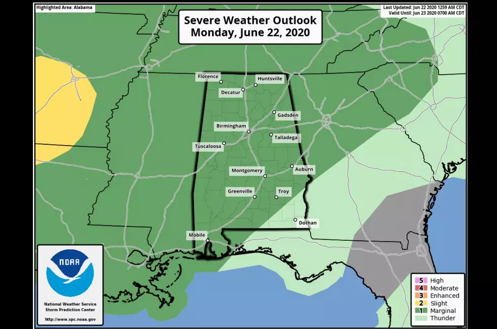
The joys of summertime in Alabama. This afternoon most of our listening areas are under a marginal risk level from the Storm Prediction Center. You can expect severe thunderstorms that could produce small hail and gusty winds. Our areas can expect this storm pattern to exist until Thursday from the afternoon into the evening hours.
I will continue to update this story with the latest weather information you need. - @MaryKRadio
Updates:
Significant Weather Advisory until 345 pm for Central Walker, Northeastern Tuscaloosa, Western Jefferson, Northern Lamar and Southeastern & Northwestern Fayette.
Tuscaloosa Airport, wind gusts were recorded at 52 MPH. Reports from ALDOT weather sensors reported gusts to 40 MPH at TTOWN I20/59. 37 MPH on US 82 at Black Warrior River Bridge.
Expired:
Significant Weather Advisory until 3 pm for Tuscaloosa, Northern Pickens, Southwestern Fayette, and Lamar County.
Significant Weather Advisory until 245 pm for Southwestern Tuscaloosa County Until 230 pm. And Southeastern Tuscaloosa County.

More From 105.1 The Block